
I thought I was going to publish an update during Harvest, but here we are deep into Leaf Fall. In this update I have left introductory text in green italics to provide an overview of my mega-project for people seeing an update for the first time. It also reminds me of what I am trying to do. Each time around I make changes to update or clarify my evolving strategies.
I am trying to manifest a vision for an “ecosystem guild”. I imagine a network of communities (groups of groups) that are collaborating in the regeneration of our lands and waters, We are guided by values, and learning how to share resources. I am trying to summon this ecosystem guild by creating what I imagine to be its necessary infrastructure.
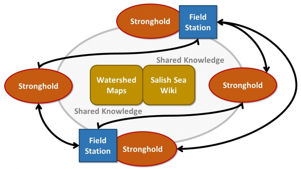
I envision four pieces of infrastructure: biocultural restoration field stations, watershed maps, an open knowledge network, and local strongholds. These four pieces work together. This framework is a hypotheses, to be “adaptively managed” (read more about my assessment framework). Maps and the wiki provide a shared platform. Strongholds gather at field stations to share resources and prototype.
Since the last update I’ve been heavily focused on building a prototype field station, and on updating and building an institutional platform for the Salish Sea Wiki.
Bio-Cultural Restoration Field Stations
Problem: Camping is the least expensive way to visit a place. It increases our connection to the land. Shared residence builds relationships. Our culture and institutions prevent us from camping in the public commons to restore and study. Commons are neglected and have become the domain of experts and institutions. Gathering to study and work thereby requires lots of preparations and cashflow. We do ecosystem work from desks and offices. In all these ways, our alienation from the living earth and each other is exacerbated. For 300,000 years in human culture we tend places through inhabitation, working, eating, and telling stories around the fire.
Target: Develop a culturally-driven process whereby groups from strongholds can gather on restoration sites for days to weeks to work, build relationships, exchange knowledge and cultivate common pool resources.
Tactics: identify initial willing land managers on public trust lands, host camping events around the restoration process, and prototype customs and infrastructure that enable self-organization and replication. Develop study and design resources that support this work. Build allies by providing a unique and valuable contribution in areas where the existing restoration industry is weak.
Guild Integration: field stations are the central social event around which the Guild develops. Field stations use the wiki to build shared knowledge. Field stations create and use watershed maps for learning, communication and as a knowledge store. Field stations are a crossroads where strongholds build relationships and exchange resources, beliefs and stories. Participating in field stations enables each stronghold to establish their own field stations.
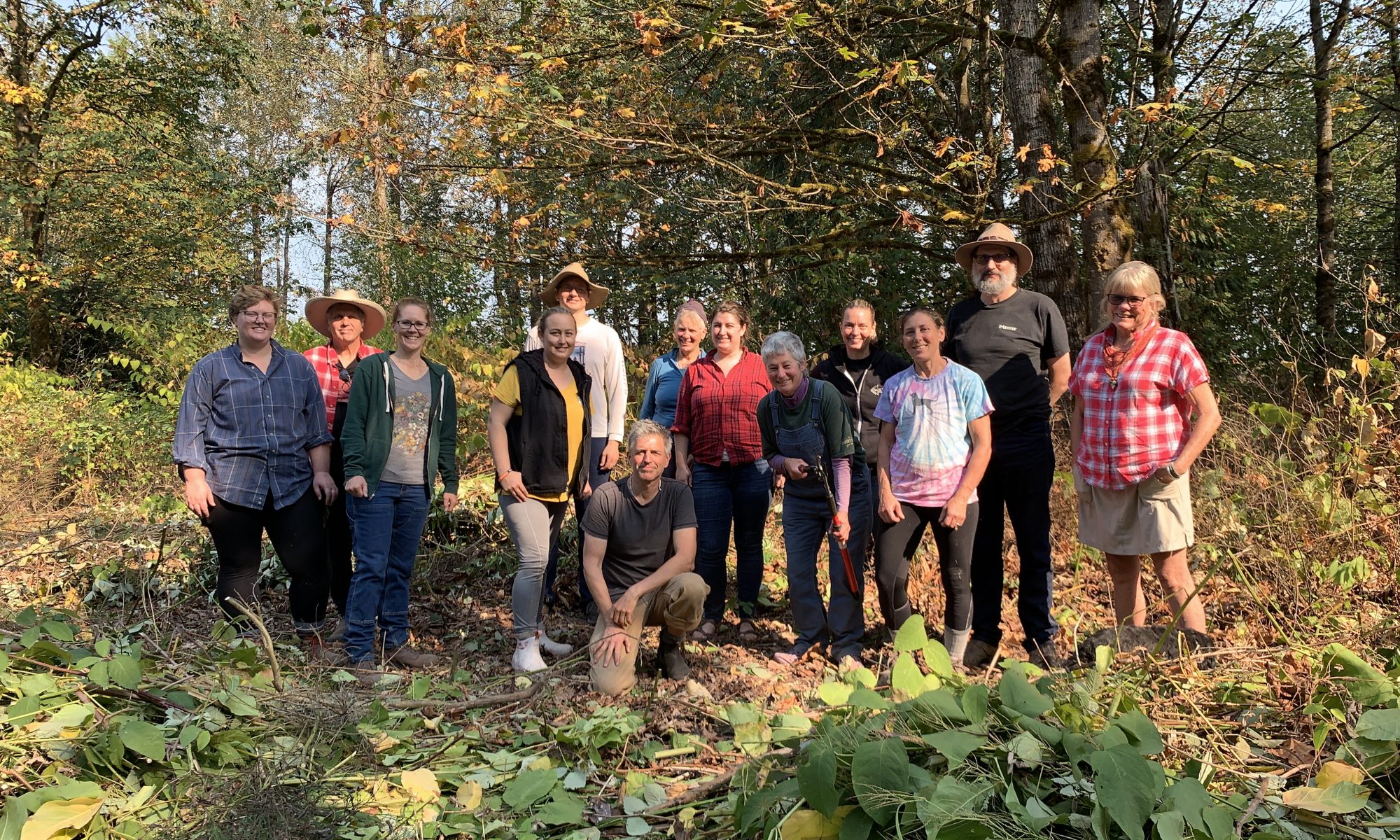
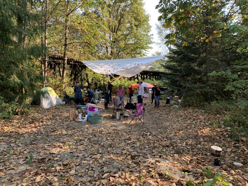
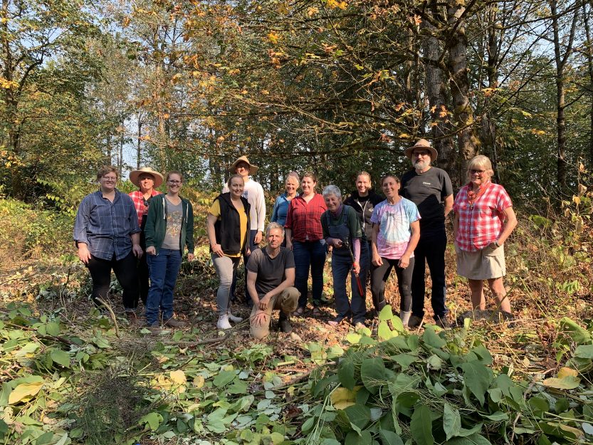
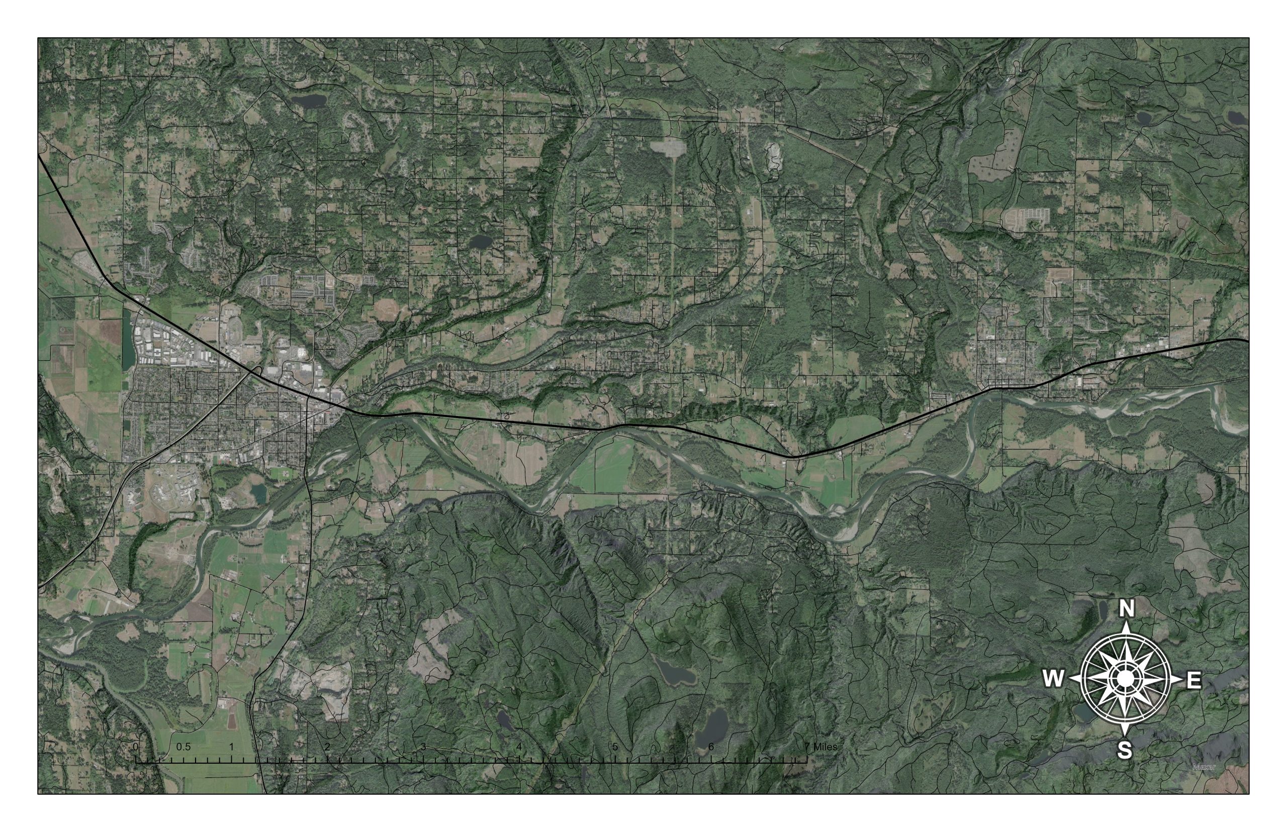
After a hustle (and with special thanks to Carrie and Sarah) we gathered at our first field station on a northern bend in the Skykomish River just outside Monroe. The land is the old 260-acre Reiner Farm, now owned by the Washington Farmland Trust, and leased to the Werkhoven Dairy. A riparian portion is ultimately scheduled to be purchased by the Tulalip Tribes of Washington.
Thirteen people arrived from 6 different social groups: Songaia Cohousing, The Pond Beyond, Portland, Olympia, Lopez Island and Burners Without Borders. We set up camp, spent the night, cleared around a 1/4 acre of knotweed and blackberry. We talked a lot. A fair amount of time was spent telling and framing the vision of the ecosystem guild and biocultural restoration field stations and how they fit into the world as we know it. Then smoke came down the valley from The Bolt Creek Fire, and chased us out.
This update is only a quick overview of the event. I need to spend more time immediately after big events to write down all my thoughts. Interestingly I’ve been reading Susie Wise’s Design for Belonging, and it has been shaping and reframing my memories. More about that later.
The structure and sequence camp was based on our draft Ecosystem Guild Handbook, which outlines roles. I played site steward and many other roles, the conservation district was our institutional sponsor, and we had five protogroups. I issued a invitation and groups arrived Friday, registering as volunteers for SCD. We opened the station over dinner around the fire covering site access details and taboos. We had our full safety training at the beginning of our morning work session, and then, having decided to abandon camp because of worsening smoke, hand a long debriefing before leaving, in lieu of our planned open space. While the camp was shorter than expected, being on site, doing a day of work, and meeting each other was more than worthwhile.
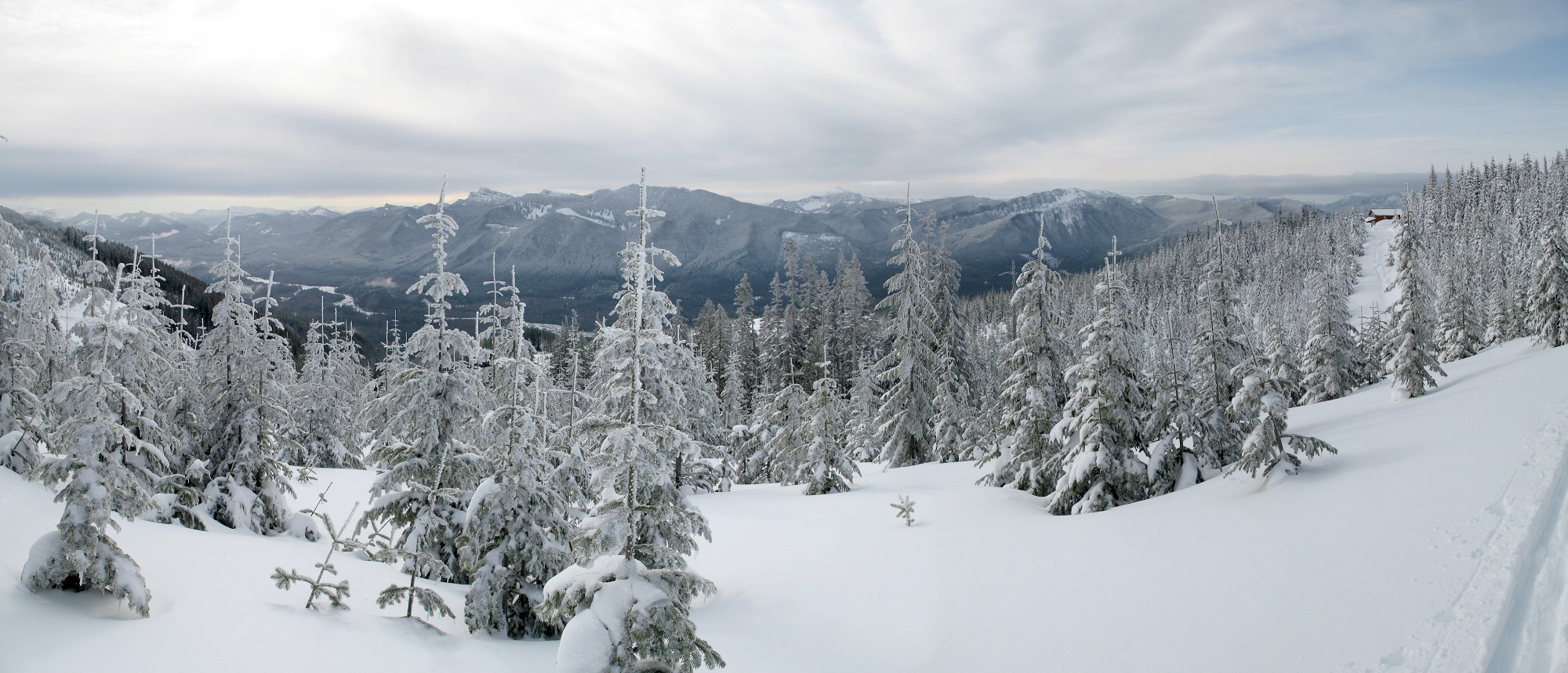
One exciting development is that this crew wants to take on winter camps! We will be scheduling a series of camps in January, February and March, and renewing outreach and recruitment. These will take our existing camp formation processes, push us to rapidly develop forest farming strategies, and increase the complexity by throwing in winter weather and earlier than expected plantings. Daily temperature runs 30-45 degrees F, you get measurable rainfall one day in two, and see a patch of blue sky one day in four. We’ll expect around 21 inches of rain in those three months (33 inches in heavy years).
Winter camp is also the time for all propagation (seeds, divisions, cuttings, transplants). Jumping into winter camp is also stimulated by resources secured from the conservation commission to acquire plants. The timing isn’t great, because we really haven’t completed a solid site assessment, and haven’t developed a strong model for vegetation communities in the valley, but we know enough to start work.
Having funding drive the program rather than the other way around is not an uncommon situation in the restoration industry. The kind of restoration I want to explore involves more site preparation and more careful timing, to enable higher biodiversity plantings of smaller stock. Its also very late in the year to procure materials. Supply lines in Puget Sound are already strained and getting plant orders lined up during summer is better practice. In the future I expect we’ll end up contract growing to achieve our desired biodiversity and to leverage seed collecting of local genetics. Now we’ll be coming into a barely cleared site with purchased plants.
We will make the best of it. I anticipate three strategies: 1) experimental seeding of native forbs on cleared bare ground between mulch strips that in the future will be scythe-mowed to suppress knotweed and blackberry regrowth, 2) fast growing trees (alder, willow, cottonwood) in the mulch strips to increase shade and provide mulch and an initial crop of poles, cuttings, bark and oils, and 3) pockets of selected species in selected and intensively prepared mother garden areas to produce divisions and seed for future plantings. In general this all involves acceleration of the management planning process in a way that undermines a nicely paced community design process. That may be OK, because perhaps by me leading the first run, I can prototype processes and resources that will support the leadership of thers, just as I have been doing with the infrastructure. There are plenty of neglected forests in our future for everyone to have a turn at designing experiments. Initial work will essentially translate syntropic agroforestry concepts, into an invasive species conversion setting, experimenting with root exhaustion in alleys and harvesting biomass from alleys into mulch strips at around a 1:4 ratio.
There were also several participants that want to involve youth and children, to make the field station available to families, which is not supported by our institutional sponsor. I think reaching this objective may require self-insurance or coordination with an additional institutional sponsor (perhaps 4H or another group that already works with kids in a community-led setting). In addition, adults working at camp with youth will likely need background checks. This challenge is surmountable, but there are so many other immediate needs, I cannot make this a personal effort right now. I also appreciate not having integration of kids at the start (spoken with the greatest love and extensive experience working with kids). Ultimately however, I think it is very important for families to be able to participate–the segregation and isolation of families from these processes seems unnatural. Part of this work is developing skill with more effective and therefore more dangerous tools. How we think about children and safety and parenting in a group field work environment however will require some careful conversations.
One thing that I do want to note: the commitment and passion of participants was very high. I suspect that for this crew to arrive at some mysterious dead end farm road, prepared to spend a couple nights demanded some effort. Because of this the people that showed up were passionate explorers. “Biocultural restoration” was the right dog whistle. I suspect that rising to challenge and sharing responsibility is an important part of this emerging system. I feel so grateful. If we can learn to continue to build our numbers and pull this halyard together it will be the beginning of something quite extraordinary. I suspect there are a large number of people who would like to spend more time living in the woods, increasing our skills, knowledge, and abilities, and working together to build a culture of stewardship.
So in short, it feels like we are on the track to a continuous seasonal schedule, with strong morale. I can also feel the pressure to accelerate the work, driven by the industry we are adjacent to. The restoration industry likes acres and miles, and has very little sense of quality or the cultural component. That dynamic will need to be managed. At the same time, my tendency is to rehearse excessively and so opening up the throttle might be a fine thing. I just don’t want us to be used by a industrial system that uses labor like it were a machine rather than a whole person.
With a draft set of dates, I am working on the next invitation to winter camps, a shared calendar, a more streamlined and distributed RSVP and registration system, and thinking through how administrative processes can differentiate between new groups and old groups, and individuals within groups that are registered or unregistered volunteers, and how to manage training and coordination among all these people over time.
So this brings me back long way around to Susie Wise’s Design for Belonging. I’ve been a book group at our cohousing community. She describes the human experience of belonging or not belonging as built from a series of moments. The moments of an experience are a kind of choreography: invite, commit, prepare, arrive, register, set up camp, introduce, explore, work, take responsibility, share ideas, express frustration, hear the needs of others. How do we cultivate a choreography that brings us closer to each other and builds a stronger more complete shared vision?
Each camp is an experiment. At this camp, the process of parking was acceptable, but could have easily gone worse. Dealing with lots of cars during arrival or an event day could be challenging. The tool shed concept worked well, but stewardship was necessary. There are lots of bits of “stuff” involved in a work camp. The sharing of food and kitchen will be a future experiment–I anticipate a tension between fossil fuel convenience and becoming wood-fired and carbon neutral. The creation of spaces was unexpected, lovely, and I think vital (who created an alter of fall offerings in the center pf the shoes off area?!). Creating a clear threshold between the parking area and the camp, including the information board, worked well if for no other reason than it kept me administratively organized and ready at the threshold. The info board is evolving to contain everything necessary in the world of paper. The process of greeting and introducing was compromised by the process of registration. There were awkward moments among people who had never met. Distributing responsibilities among recurring guests will make it all flow more beautifully. I could feel a deep sense of shared care.
Having more than one day of work will be very valuable. We could spend more time after a day revisiting the strategy, the results, walking and talking and comparing different outcomes and how those outcomes affect future choices. There is a lot of value and importance in the nuance of work–how one quick choice, quickly drivers another choice, leading down roads you may or may not want to be on. You can double your work and halve your effectiveness by not seeing the details and implications, or not taking them seriously. The labor management was very challenging at a 1 to 12 ratio over one day. We left a bit of a mess for the next crew, but in all fairness we were hoping for another day. All that said, I can see down the road, when we become more comfortable with our techniques and strategies, how powerful this format will become. When we become a recurring crew with shared knowledge and traditions, we will be so powerful!
Carrie and I are presenting to the Snohomish Conservation District Board of Supervisors, to fill them in on the process we have initiated. They agreed to support the volunteer policy, and want to hear a little more about what we have talked them into. They are an elected body for Snohomish County. I am a little apprehensive if they get preoccupied with the wilder edges of my big picture thinking (my industry tends to prefer the practical outputs of known quantities) but I think they will appreciate the approach.
Another piece of the puzzle that I am excited to test is a work tracking and social feedback mechanism. This is described in The Handbook as the “field station log”, and hasn’t been implemented at the Skykomish Field Station. We need a tool that makes it easy for any individual to contribute to the shared learning and memory of a field station. This tool will need to help us refine our contributions and build over time. I can’t wait to get this piece in motion. The coherence of information flow is so important for experimental restoration work and is so poorly modeled in our existing on-the-ground restoration systems. Our culture is also pretty wrapped in shame and ego, so creating learning environments can be hard. Ultimately one of the special contributions of the field stations will be to support learning. Documenting what we do were is critical for this. We need to learn to set goals and remember.
Needs: The greatest challenge is to start distributing responsibility for the infrastructure. I have one group that has expressed interest in hosting a kitchen. I developed a very detailed breakdown of roles as a way of debriefing myself. I was running a large number of roles in parallel, as well as letting a number of roles go unattended. A strong need is for groups that have participated in one field station to participate in future field stations, to create that continuity and develop our ability to remember and refine systems that serve our shared goals.
Links
Biocultural Restoration Field Station Wiki Page
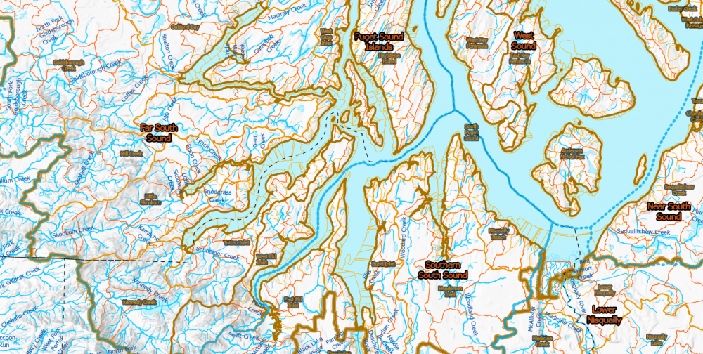
Watershed Maps
Problem: maps define how we perceive the landscape, and we have no system for creating, sharing and updating maps that define the ecological and social systems in which we live. Without maps we are blind and dependent on others to interpret reality. Abstracted from place, ecological knowledge becomes weak. Maps are a key form of knowledge storage.
Target: build a system for production, distribution and improvement of maps at multiple scales that use best available data to construct a clear picture of our bioregional ecological and infrastructure systems: transportation, water, land use, soils, topography, and habitats (see assessment framework).
Tactics – develop a print-on-demand web store, start producing and distributing prototype maps. Use existing public data to build a series of GIS projects that allow me to rapidly generate useful maps at a site, landscape, and watershed scale.
Guild Integration – maps become a tool for supporting the identity of strongholds, and strengthening stronghold coherence, and teaching bioregional literacy at a territorial scale in a way that is connected to local reality. Field stations store knowledge in maps. Maps describe repeated patterns in the landscape that leads to shared strategies.
I have set aside the map making venture a bit in favor of working on field stations and the wiki. Watershed Maps is up and running.
I did crank out a quick set of maps to support education about the Lower Skykomish River Valley, and they are now available on the Wiki. I suspect there is a standard set of assessment tools that can be developed regionally and produced for any landscape unit to support biocultural restoration work.
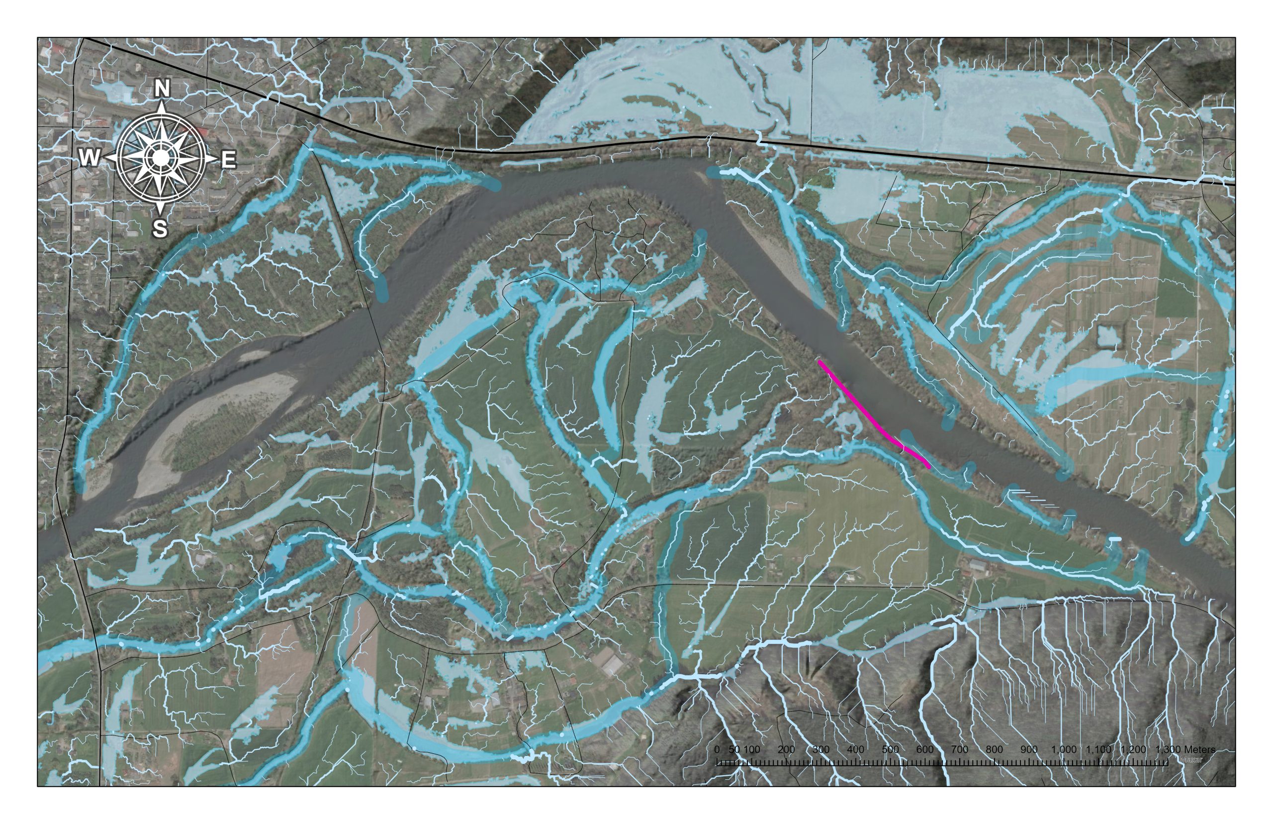
This first set of maps provides an overview of a floodplain reach that puts the site in a landscape context.
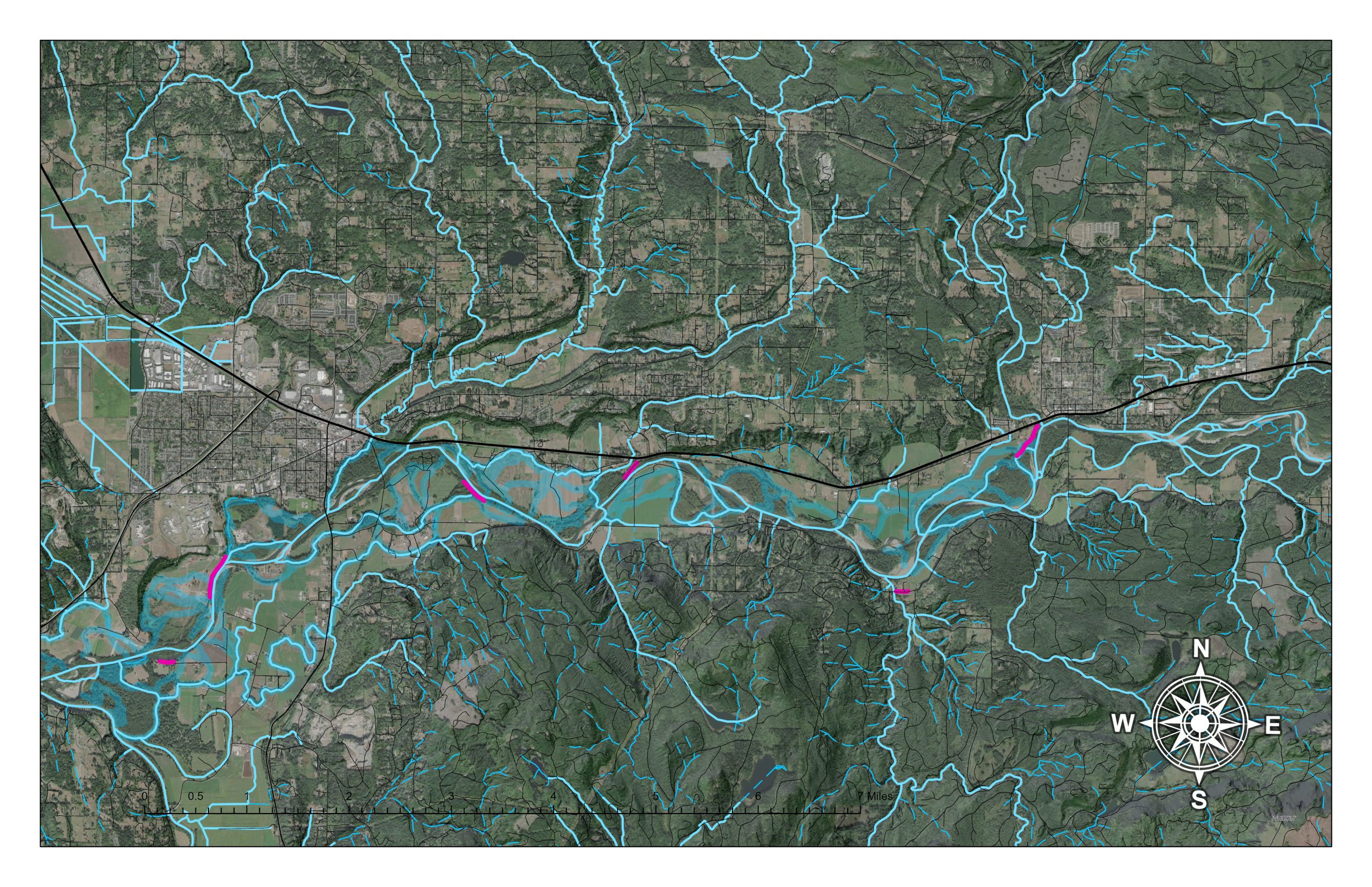
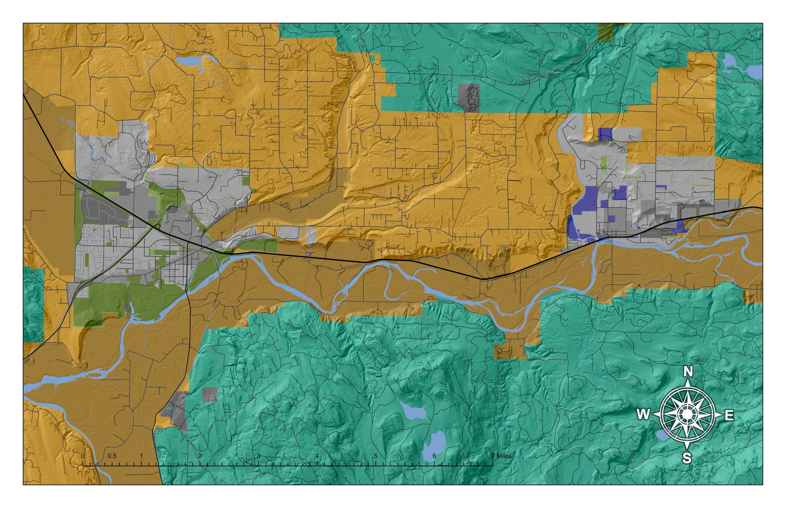
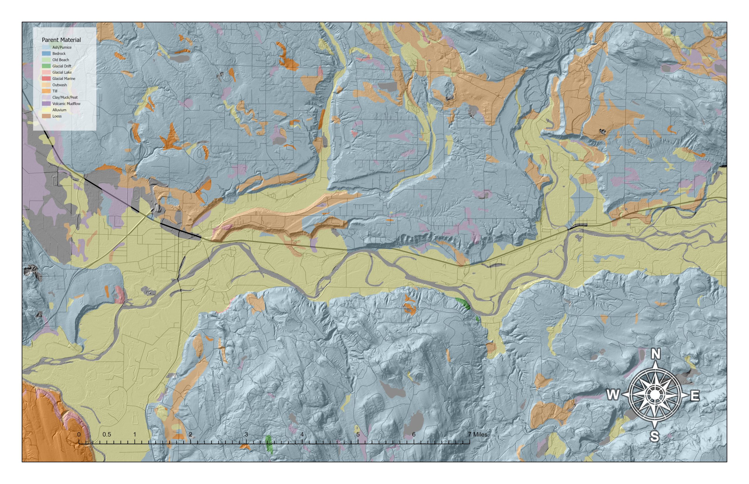
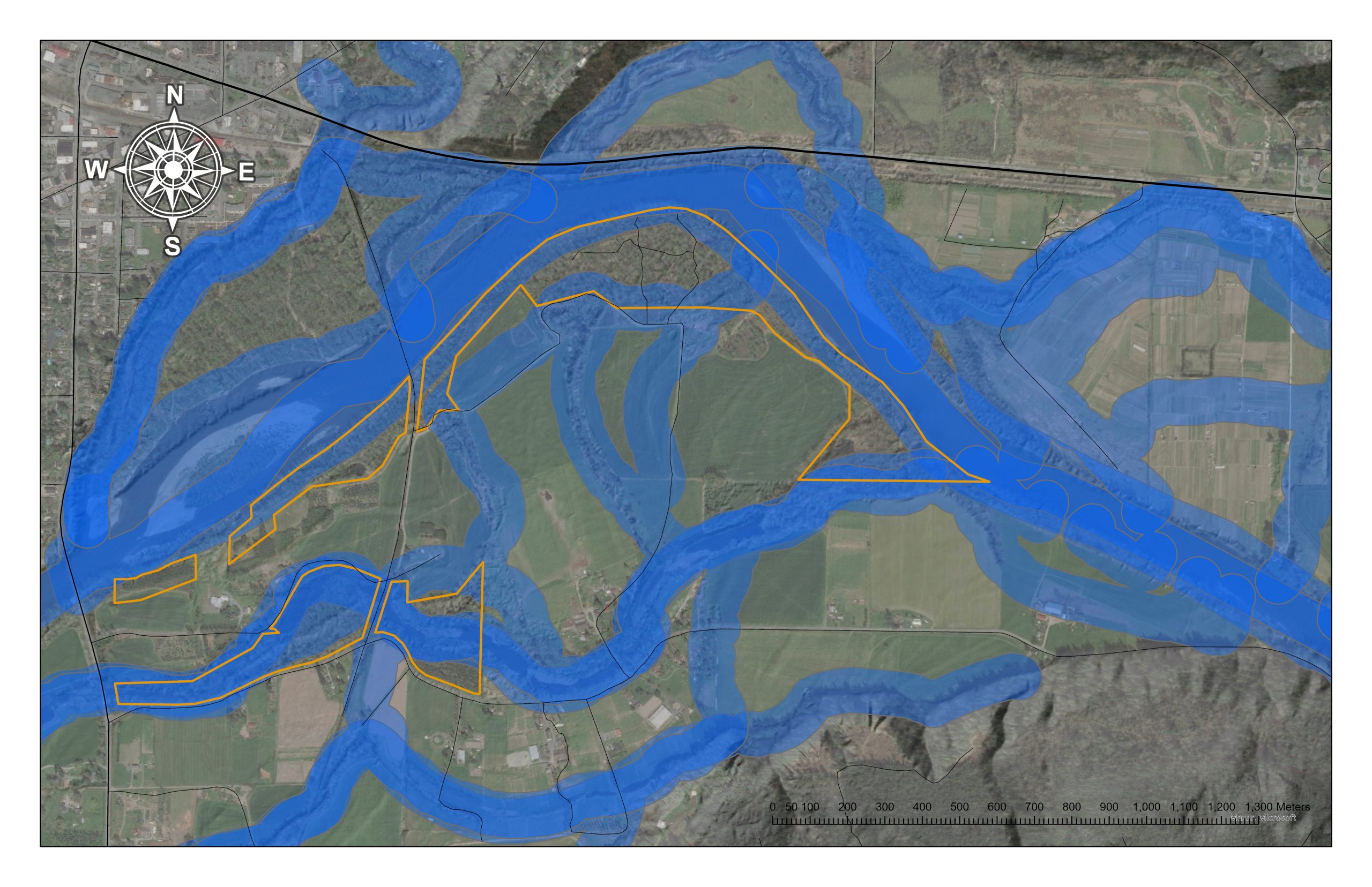
A second set of maps (below) supports site-scale landscape analysis–placing work areas within a local geomorphic context. These maps often require accessing county level analyses. The maps shown below shows hydrology layers I generated through analysis of digital elevation models. These initial maps don’t include new layers I have recently acquired that describe relative flood frequency and depth.
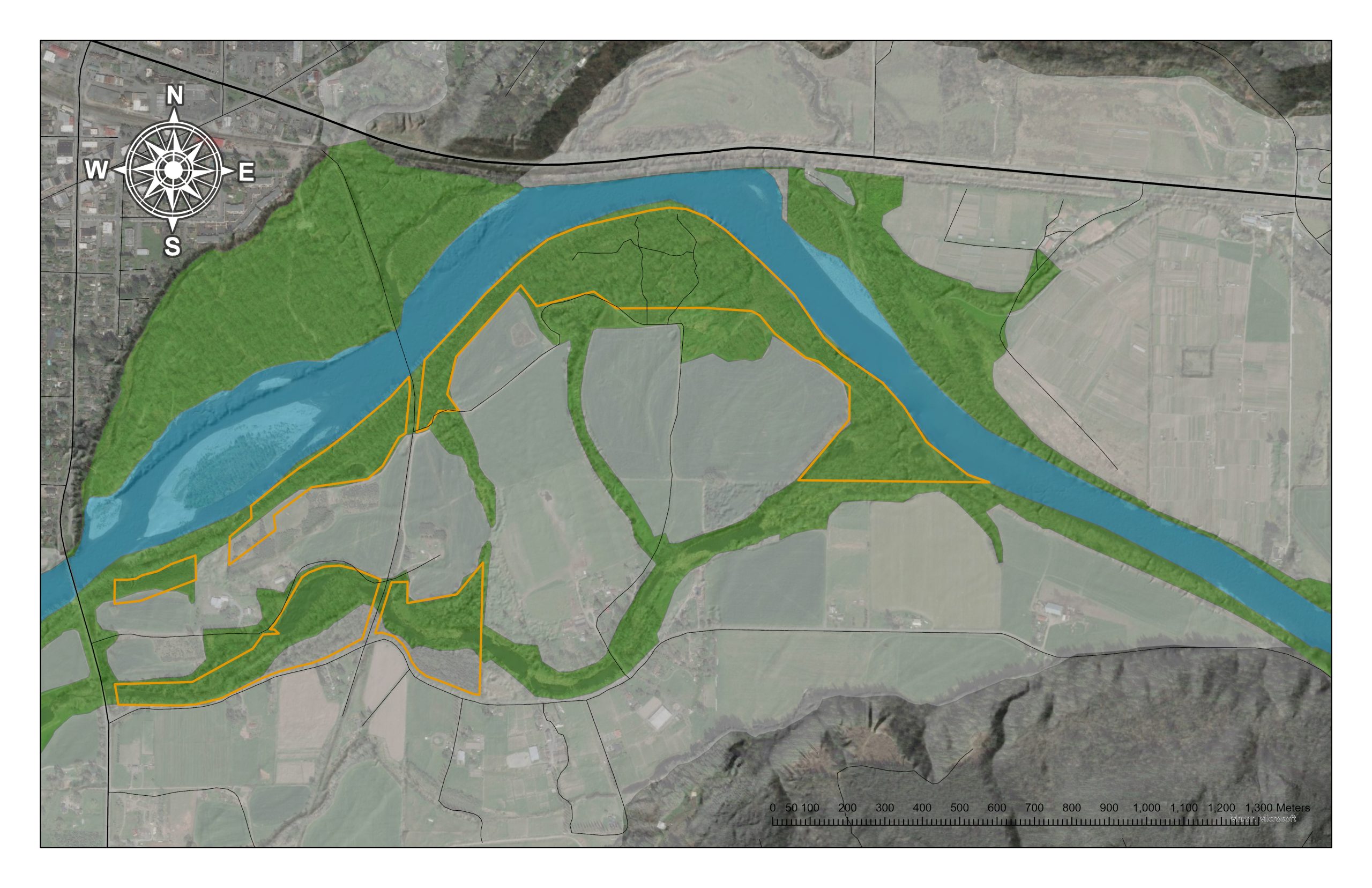
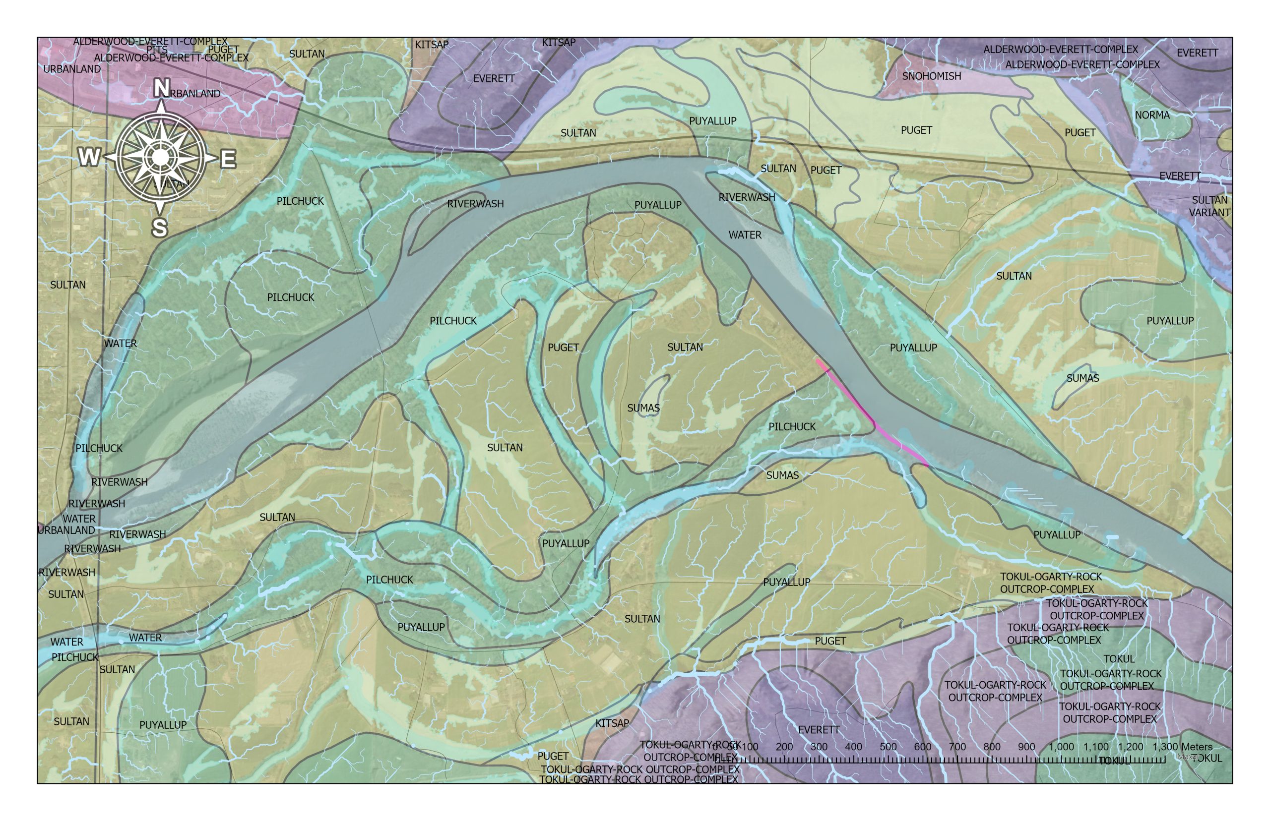
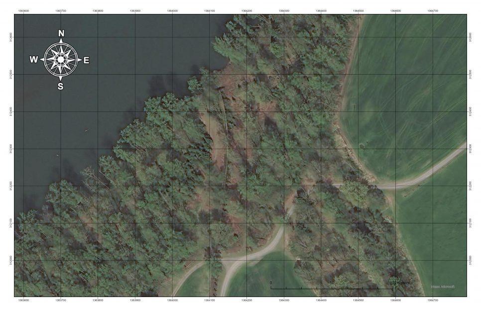
Finally there is a third set of maps that are useful for site documentation work where we can delineate zones to document our work in the context of local vegetation and landform. While google and bing have tiled aerial photo layers, there are higher resolution aerial images that can be had from county-acquired overflights that give us 6-inch pixel resolution. With these higher resolution aerials, trees become landmarks for finding your way on sites. Zone delineation lets us estimate area. Quantifying area helps us project labor, supplies, and productivity to new sites.
NEEDS – I would love to create a series of videos that provide everyone with an introduction to the site before arriving at camp, but I won’t have time for that without help. I would love to distribute any ecological maps if you’d like to use the watershedmaps.com site.
LINKS:
Salish Sea Wiki
Problem: knowledge storage and retrieval among ecosystem management institutions is dysfunctional, with critical knowledge of our social-ecological systems alternately hoarded or lost. Only insiders know how ecosystem management works. Existing agencies and their websites are forgetful and shallow, and tell stories to promote institutions and obscure deep knowledge of place.
Target: A mixture of bureaucrats, scientists, students, activists and volunteers tend an open knowledge network that enables cross-institutional knowledge capture, storage and retrieval about social and ecological structures, processes, and dynamics in the Salish Sea. Knowledge is organized around places, efforts and topics.
Countermeasures – move salishsearestoration.org to the Society for Ecological Restoration as a bioregional prototype, upgrade the system, and develop a broader community of practice, by finding clients, and integrating wiki use into existing programs and efforts.
Guild Integration – the wiki provides a platform for organizing field station resources, supporting educational processes, and becomes a free platform for strongholds to document their situation, and share knowledge among similar situations. It benefits from and builds on the watershed maps, as we work toward map integration.
We are in position for a major upgrade to the wiki. We have a great vendor in hand. The scope of work and costs are defined, and funding is in hand. The Society for Ecological Restoration has agreed to be the institutional sponsor. We are now grinding through the process of actually getting a contract in place.
This is just in the nick of time too! The wiki is long overdue for a version update. The site is starting to crash with “504 gateway timeouts”. Unfortunately I don’t know what that means and am completely dependent on a volunteer host who has been supporting the wiki for far too long without compensation. It will work out in the end, but it has been so slow.
The wiki upgrade is creating mechanisms for reconsidering and improving our category taxonomy, as well as the motive to start considering the spatial strategy. Ultimately, I would like the wiki to be organized around user-defined places. A place is some geography with a natural ecological and social boundary that means something to someone. All the systems created top-down by regional assessments are great building blocks but they don’t reflect personal or actual social-ecological dynamics. Social-ecological systems have a quality that is not revealed through landscape analysis. It is learned through participation. I think using the wiki to capture this sense of place will be important.
However, while each place is unique, there are recurring patterns of place that define the kinds of pressures and injuries and responses that similar places may call for. Two places on opposite sites of the Salish Sea may face very similar challenges. Can the wiki be designed to help people in those places find each other and find common cause?
The restructuring of categories will be implemented through use of the Cargo Extension which will allow association of data with specific pages, including a relational database of categories, spatial data, and will support the use a page template for quality assurance. Here is a draft peak at the evolving wiki category schema. I am consulting with agency allies to figure out how the wiki can reflect the way that current institutions think about knowledge and topics, and have been reviewing the DPSIR framework, for all its warts, to support that consideration.
Lots more to come on this front.
LINKS
Networks of Strongholds
Problem – The restoration industry is poorly resourced compared to the challenges we face, and we struggle to evolve, corrupted by hierarchical institutions and disconnected from place. Outsiders attempting to influence ecosystem management don’t have access to insider knowledge. Our institutional structures don’t create synergy between professionals and activists who share ecological goals within a place. We don’t have a long-game vision for how to reform local governments.
Target – Build strong local networks among groups to form “groups of groups” that are organized around a coherent vision for a regenerative bioregional future–something between a template and a checklist that defines local infrastructures, and the necessary local government mechanisms to create those infrastructures. Create resource sharing systems that let groups self-organize in common cause, and leverage each other’s accomplishments.
Tactics – To be determined. Some combination of native agroforestry, technical, political and legal action around Growth Management Act and Shoreline Management Acts, a systematic approach to code revision, and infrastructure for co-education and apprenticeship, maybe related to field station events.
Guild Integration – the wiki provides an information sharing platform and a tool to support collaboration on issues and projects within and among strongholds. Field stations provide opportunities for learning and networking among strongholds and watershed maps help seeing territorial patterns, system analysis, and design objectives based on landform and settlement structure.
At this point in time, my work on local strongholds is necessarily going to slow way down. Olympia Coalition for Ecosystems Preservation is doing exciting work I would love to support. There are exciting grant opportunities emerging out of the Strategic Initiative Leads using federal funds. I have more project concepts than I can build teams and write grants. I want to start looking into a college student mentorship program, but the graduate student lifecycle is mismatched to doing real work.
Two of my cohousing neighbors are excited to start campfires. As we come into the transplanting season I want to get my nursery in the ground, and plant a new wave of seeds, cuttings and divisions. I am starting to talk with some community allies about investing in more fruit trees and forest edge restoration for forage. As a housing cooperative, we have the opportunity to offer housing as part of a relationship with folks. Our community is getting old, because we don’t offer rental group housing. How does this overlap with internship?
More community development and the neighborhood scale will need to wait. All will come in good time. What I do want to do is to strengthen and reach out to friends and colleagues who want to build a Olympia Crew that can regularly participate in field stations. I have been so focused at the regional model development scale, I haven’t spent the time building my own group.
The 2023 city council election will include four of seven seats. Developing a bioregional vision statement around that election may be a useful play to start considering.
Development of a field station on Skookum Creek or on Henderson Inlet, or even at the Cooper Crest community forest are all possibilities that would accelerate group formation. Having somewhere to gather, and something to gather around has value.
Patience. Field Stations first, stabilize the wiki, then strongholds.
NEED – I am happy to connect people to any Olympia networks if you are interested, and would like to provide a way of providing peer support and mentorship for people trying to make sense of local challenges through a collapse-informed, bioregional and biocultural lens.